Village Kot · Tehsil Ranikhet · Almora
≈5,000 ft ASL
Alpine
Meadows
21.55 contiguous acres · Above Village Kot
Tap a marker · scroll
Uttarakhand has no shortage of hill land for sale. What it has almost none of is large, contiguous, clean-title land inside an established hill station — assembled parcel by parcel over more than a decade, and held as a single walkable estate rather than a scattered book of plots.
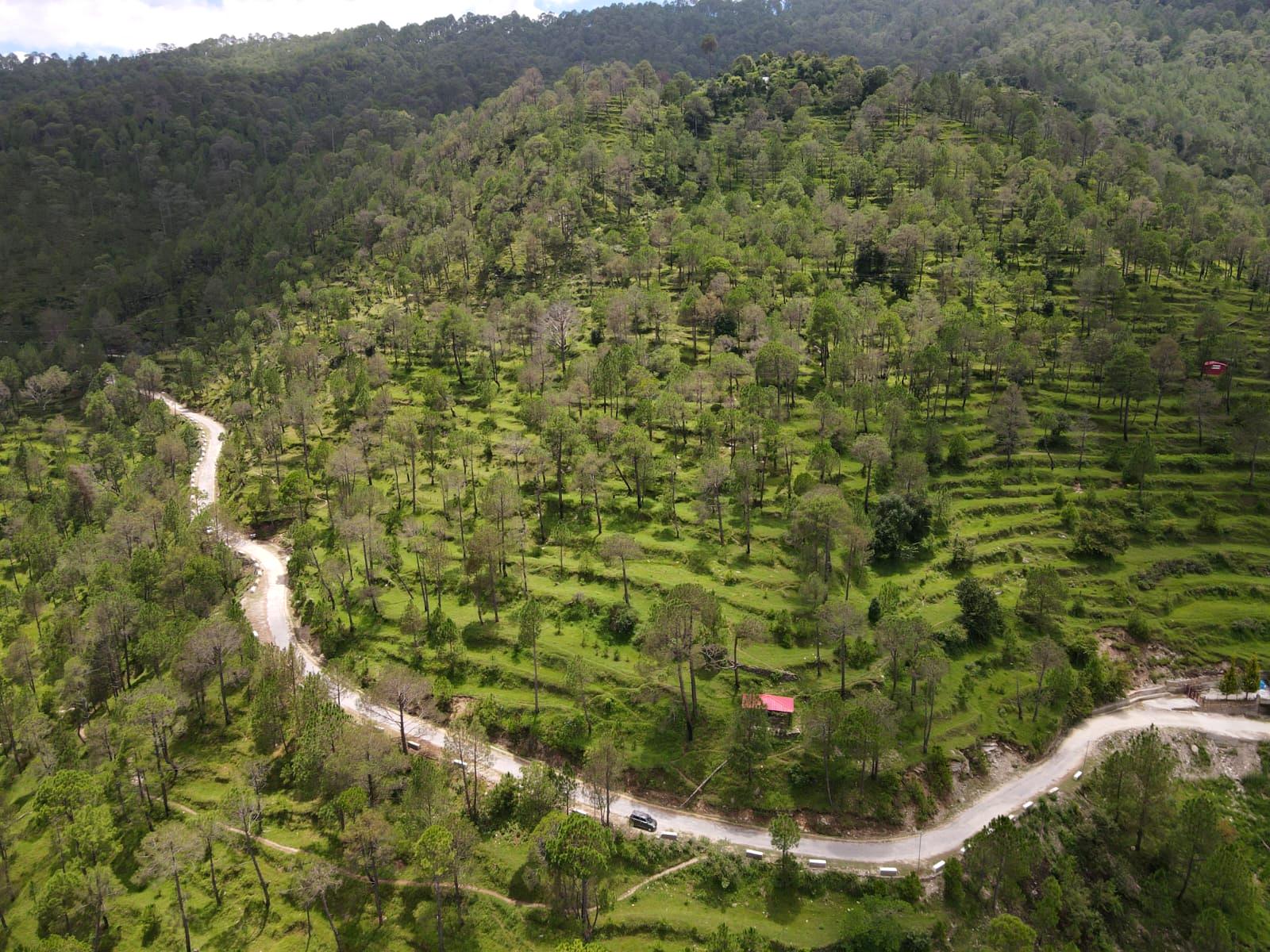
That is the asset. The terraces you see from the air were cut by farmers over generations; the development sits into them rather than erasing them.
| Total extent | 21.55ac |
| In local measure | 436.20Naalis |
| Altitude | ≈5,000ft |
| Phase 1 plots | 73nos |
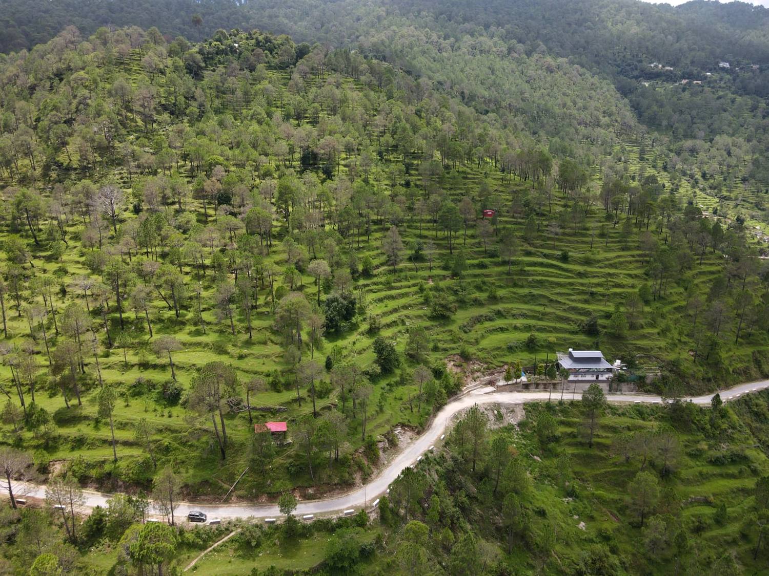
Every contour in this frame is an existing agricultural terrace. They set the plot geometry, carry the drainage, and mean the estate does not begin with the expense and scarring of large-scale earthwork.
Mature pine across the slope stays. Density is set at 73 plots across Phase 1 — 1.25 Naalis each, roughly 2,700 sq ft — so the tree line reads as forest with houses in it, not a subdivision with planting.
The estate is served by an existing all-weather road along its lower edge — visible here — rather than a track that has to be built before anything else can start.
Plotted directly from the contour survey drawing. Toggle the layers, drag to pan, scroll to zoom, and hover any plot for its dimensions.
| Surveyed area | 87,240.9sqm |
| In acres | 21.55ac |
| In local measure | 436.20Naalis |
| Extent | 612 × 299m |
| Phase 1 land | 100Naalis |
| Plots | 73nos |
| Saleable area | 91.25Naalis |
| Share of estate | 23% |
Boundary, contours and roads are plotted from the topographic contour survey by Horizon Engineering & Consulting (ref HEC/2025-26/09/213, 29 September 2025). Phase 1 is 100 Naalis at the eastern end, where road frontage is strongest, carrying 73 plots of 1.25 Naalis per the architect’s layout. Plot positions here are an indicative fit at true scale, pending the layout drawing.
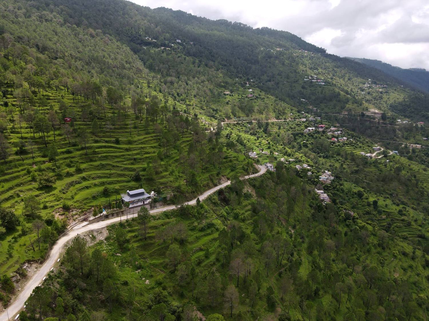
The estate sits above a working Kumaoni valley with an established village, school and market within reach — the difference between a holiday asset that functions year-round and one that empties in November.
A single-day drive from the capital. Completion of the Moradabad–Kashipur highway, expected 2027, is projected to bring this to 5.5 hours — the threshold at which a hill property becomes a weekend proposition rather than an annual one.
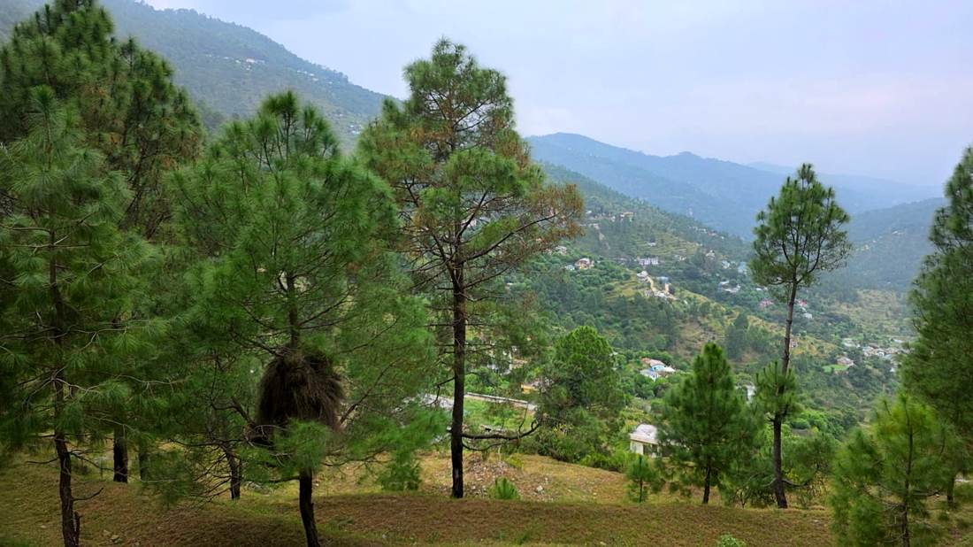
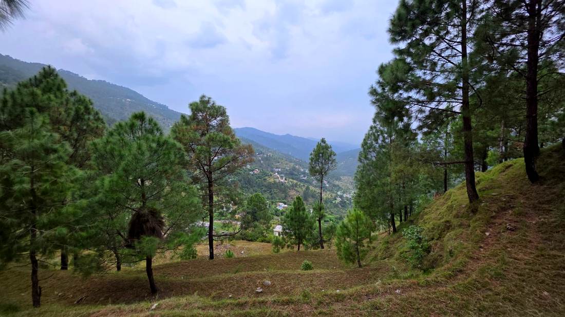
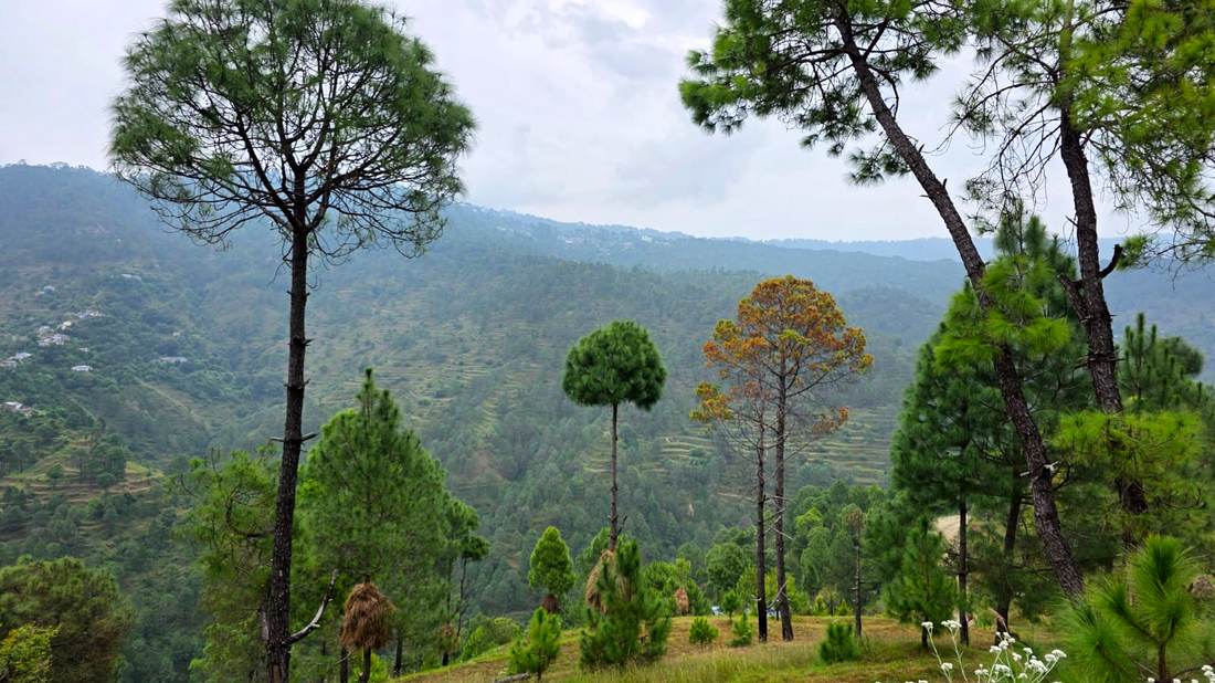
Photographed on site. Deodar and chir pine, cut terraces underfoot, and an open aspect across the valley from almost every plot.
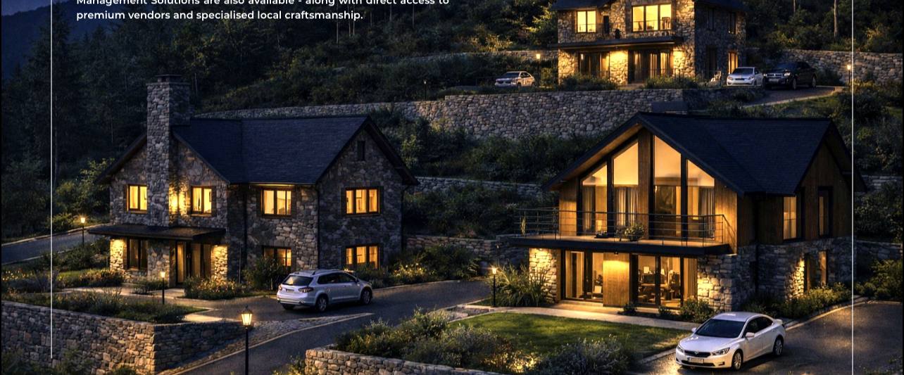
Design intent for the estate: stone-and-timber cottages set into the existing terraces, with plug-and-play infrastructure — internal roads, street lighting, dedicated water supply, power backup and mountain-grade fire protection.
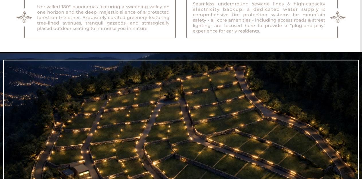
Phase 1 comprises 73 plots of 1.25 Naalis each, released in limited tranches. Site visits are by appointment — the estate is a day's drive from Delhi, and the terraces are best read on foot.
| Estate | 21.55ac |
| Altitude | ≈5,000ft |
| Phase 1 plots | 73nos |
| Plot size | 1.25Naalis |
| From Delhi | 6.5hrs |